Overview of Winter 2023-24 So Far
A quick preface to this post: I am currently in the midst of an extremely busy and stressful time frame work-wise, and have taken a social media hiatus to devote my full attention to work. But even so, I'm too much of a weather nerd to totally avoid looking at any real-time weather data in the little spare time I have. This post is a collection of thoughts on the recent and extended range pattern I've collected gradually over the last week, while writing this post out over the course of a few days late in the evenings and in between lengthy waits for file transfers. This will be my last blog post in the meantime, unless a legitimate major snowstorm potential materializes for the Mid Atlantic/Northeast region.
The winter of 2023-24 has been quite different than last winter to date – most notably, with a strong El Nino instead of the previous three-year La Nina episode, and with actual snow events in parts of the Mid-Atlantic region. In other ways, it is also similar to last winter, with multiple long-duration anomalously mild episodes across much of the North American continent, and a transient major cold outbreak – in December 2022, and now January 2024 – that, while impactful, was the exception in an otherwise mild winter.
For the purposes of this post, usage of terms such as "anomalously warm" is in reference to temperatures being much warmer than average. It does not necessarily mean that temperatures are actually warm, but rather in reference to temperature anomalies, unless otherwise stated that mild temperatures (here defined as generally 50°F or warmer) are possible.
For the purposes of this post, usage of terms such as "anomalously warm" is in reference to temperatures being much warmer than average. It does not necessarily mean that temperatures are actually warm, but rather in reference to temperature anomalies, unless otherwise stated that mild temperatures (here defined as generally 50°F or warmer) are possible.

500-hPa geopotential height anomalies for December 11-31, courtesy of ESRL's NCEP/NCAR reanalysis plots.
This plot shows the 500-hPa geopotential height anomalies for most of December, and January to date. Mid-late December had all of the classic features of an anomalously mild North American pattern – negative NAO with persistent troughing across Greenland, working in tandem with Alaskan and northeast Pacific troughing to result in a mild Pacific airmass spreading throughout much of North America. The greatest warm anomalies were concentrated over Canada, as mean southwesterly flow aloft meant near negligible pathways for frigid Arctic air to advect southward into Canada and the US. The result was a series of cutoff lows and cyclones undercutting the Canadian ridging, but with a near total lack of any substantial cold air, led to many mild rain events in the East Coast event with cyclone tracks that normally would produce snow in their cold sector during winter.
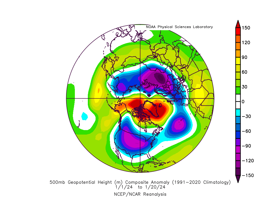
500-hPa geopotential height anomalies for January 1-20, courtesy of ESRL's NCEP/NCAR reanalysis plots.
Now let's look at the height anomalies for January to date. This is a very different picture from December, most notably with persistent high-latitude blocking. This prolonged blocking episode was in part a combination of constructive interaction between a weakened lower stratospheric polar vortex, following multiple stratospheric warming episodes with one marginally qualifying as a sudden stratospheric warming (SSW) event, and multiple cyclonic wavebreaking episodes in the North Atlantic allowing ridging to build north of the UK, split off from the main waveguide and becoming a block, and retrograding west towards North America, which I discussed briefly in my last blog post.
In addition to Alaskan ridging, this allowed a lobe of the lower stratospheric/upper tropospheric vortex to cut off over Canada and become displaced towards the Hudson Bay. Such a configuration is commonly associated with major central US cold air outbreaks, and indeed this is what we saw. Relative to the last major cold outbreak, a historic one in January 2021, the southern extent was not as notable, the core of the cold was farther west as indicated by the mean trough axis leaning towards the Rockies, and the duration was shorter as well.
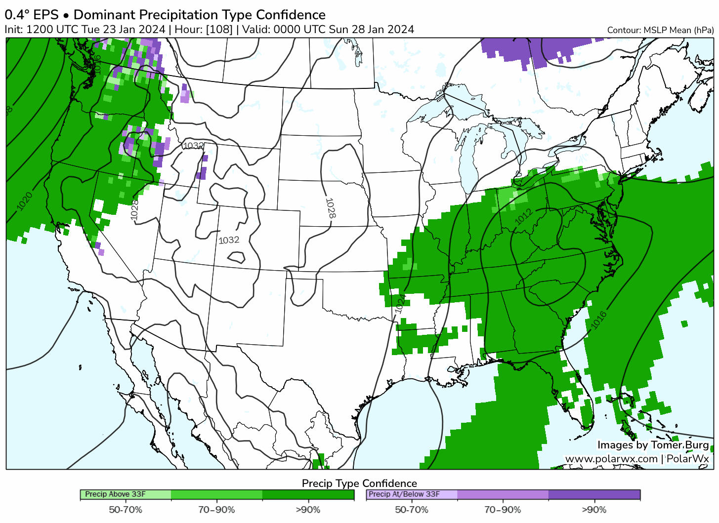
This configuration initially favored the Plains for major snowstorms, as a deep trough axis was centered over the southwest Rockies in addition to a Greenland ridge linking with a broad eastern US ridge. Following a transient shift to western North American ridging, the mean trough axis shifted farther east, but the waveguide became more progressive as well, resulting in only minor to locally moderate snow events in the Northeast and Mid Atlantic. January 19-20 specifically came close to being a much larger snow event, having many of the ingredients typically associated with major snowstorms, but the upstream trough was too flat, too progressive and not deep enough. From a research perspective, this may be an opportunity to run feature perturbation experiments to test just how close this came to a major snowstorm.
In addition to Alaskan ridging, this allowed a lobe of the lower stratospheric/upper tropospheric vortex to cut off over Canada and become displaced towards the Hudson Bay. Such a configuration is commonly associated with major central US cold air outbreaks, and indeed this is what we saw. Relative to the last major cold outbreak, a historic one in January 2021, the southern extent was not as notable, the core of the cold was farther west as indicated by the mean trough axis leaning towards the Rockies, and the duration was shorter as well.
This configuration initially favored the Plains for major snowstorms, as a deep trough axis was centered over the southwest Rockies in addition to a Greenland ridge linking with a broad eastern US ridge. Following a transient shift to western North American ridging, the mean trough axis shifted farther east, but the waveguide became more progressive as well, resulting in only minor to locally moderate snow events in the Northeast and Mid Atlantic. January 19-20 specifically came close to being a much larger snow event, having many of the ingredients typically associated with major snowstorms, but the upstream trough was too flat, too progressive and not deep enough. From a research perspective, this may be an opportunity to run feature perturbation experiments to test just how close this came to a major snowstorm.

Map of the number of days since the last 2-inch two-day snowfall. Data courtesy of the NOHRSC snow analysis.
As a snow enthusiast that lives near New York City, it is also only appropriate I add a section about the ongoing NYC snow hole. "Snow holes" are an interesting phenomenon – sometimes they are merely a subjective perception, other times they are actually supported by evidence. Furthermore, snow holes are relatively short and merely statistical artifacts in decadal and multi-decadal timescales. Such snow holes have happened in most winters in the region, and in some cases over populated areas too, such as 2016-17 and 2017-18 in Washington DC, and 2019-20 in Philadelphia. It now appears to be New York City's turn to experience the "snow hole". There are numerous metrics to quantify this snow hole in NYC:
- Days since the last 2" snowstorm: It has been 722 days and counting since the last time Central Park recorded both a one-day and two-day cumulative 2" or greater snow total. This is a record for both metrics.
- Spatial maps: Nearly all locations north, west, south and east of NYC have had greater cumulative snowfall this winter to date. Specifically, NYC is the only major I-95 city north of Richmond to have received less than 3" of snow this winter, and among Mid Atlantic cities, both Washington DC, Baltimore and Philadelphia have received at least one 4-6 inch snow event.